The global aviation industry has been facing the worst peacetime crisis following the outbreak of the Covid-19 pandemic early this year.
Covid-19 lockdowns have led to an almost complete standstill in airline travel worldwide. Many airlines have grounded almost all their flights, globally.
An unexpected and worrying downside of Covid-19’s impact on flying is now being reported by weather forecasters. Crucial weather observations supplied by commercial aircraft have now been dramatically cut after the grounding of most of global fleet.
There is a notion that modern weather forecasting relies solely on satellite data and ground-based radar. While that is true to a large extent, commercial airplanes also play a vital role by providing real-time data and observation that is not always easy for other instruments to detect.
There are just a quarter of the average 800,000 daily readings of temperature, wind strength and direction being sent automatically from aircraft during flight.
The impact on weather forecasts is “significant”, says the Geneva-based World Meteorological Organisation (WMO). “Aircraft contribute a lot to the accuracy of forecasting of most weather systems and phenomena, including forecasts associated with systems like hurricanes,” points out WMO scientific officer Dean Lockett.
Lockett coordinates international activities of the WMO Aircraft Meteorological Data Relay (AMDAR) system, which supplies weather data to the organisation’s Global Observing System.
It is the backbone for all weather and climate related information for the 193 WMO member states, according to the International Air Transport Association.
“Even though aircraft fly around hurricanes to avoid the worst of the weather, the data they collect is still critical because it feeds into forecasts for the intensity and future track of such systems,” he said.
“It’s been shown that this data is very important, affecting computer-based modelling and the prediction of those types of systems.”
The instruments on airplanes not only allow immediate observations but data provided by meteorological instruments also enable weather forecasting models to be more accurate.
Typically in North America and Europe, commercial airplanes would blanket wide areas, often overlapping near major cities.
As flights are being cancelled due to the coronavirus pandemic, analysts say less aircraft in the air means less weather observation data collection by these planes.
The Atlantic hurricane season runs from June 1 to 30 November, with the eastern Pacific season covering May 15 to November 3.
Information from commercial planes is one of several sources that meteorological bodies use to predict the weather, analysts say.
Altogether millions of readings from aircraft, satellites, ships, ground stations and weather balloons go into modelling the Numerical Weather Prediction (NWP) systems, which provide the basis of global weather forecasts.
In normal times, observations from aircraft increase the accuracy of weather forecasts about 10%. Without that information the model is significantly degraded, says Lockett.
The WMO is still assessing exactly how seriously the loss of data will be to the accuracy of weather modelling. Through AMDAR about 250mn observations a year are fed into computer models at the US National Weather Service.
As of March-end, data provided by US aircraft had dropped by half, IATA noted in a recent analysis.
At the European Centre of Medium Range Weather Forecasts (ECMRWF), readings provided by aircraft across the continent has been cut by 80%.
The centre estimates that if all data provided by aircraft was cut off the accuracy of weather forecasts would fall about 15%.
Airlines themselves also lose out. Information on wind strength and direction is used to calculate wind shear, the location and strength of the jet stream and conditions that can cause icing. It is used by pilots to plot the quickest and safest route around bad weather.
Less than 18 months ago, IATA launched the ‘Turbulence Aware’ program using turbulence measurements from aircraft to improve the safety for crew and passengers and optimise fuel burn.
Airlines use these reports collected and disseminated by IATA in real-time to make operational decisions about turbulence mitigation.
The program has gained strong industry support with some 35 airlines participating in the operational pilot in 2019. The program has since become fully operational.
Meanwhile, IATA is also working with the WMO to expand the global coverage of AMDAR. Currently, 43 airlines support the system.
On average, an aircraft will send around 100 or more observations per flight, most coming during the ascent and descent. “We are trying to capture a snapshot of the atmosphere in the vertical and the first five to six kilometers are particularly important,’ says Lockett. “And the more readings we have, the more accurate the modelling is.”
The information is particularly important for a 24-hour snapshot of the weather but the WMO is also building a database that could be used in climate change modelling.
Weather data collected by commercial aircraft and even ground stations form critical parts in models that forecast extreme weather events, says a report in ‘GIS Lounge’.
Such models keep us safe in a time of increasing frequencies of extreme weather, due to climate change, that also endangers life. But for now, these models may be less accurate due to the grounding of flights, while remote stations may also begin to cease operation due to a lack of maintenance.
* Pratap John is Business Editor at Gulf Times. Twitter handle: @PratapJohn

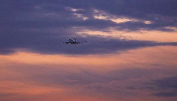
A passenger aircraft flies at dusk from Frankfurt Airport. An unexpected and worrying downside of Covid-19’s impact on flying is now being reported by weather forecasters. Crucial weather observations supplied by commercial aircraft have now been dramatically cut after the grounding of most of global fleet.

