At least 225 animals have died in the Kaziranga National Park in Assam as a second wave of devastating floods lashed the state, park officials said yesterday. As of yesterday, 30% of the park was still inundated.
Earlier this month, the first wave of floods had submerged over 70% of the park and led to the death of 105 animals, park director Satyendra Singh said.
“The flood water is starting to recede but the pace is very slow,” Singh said. “It will take a few more days to completely recede.”
The dead animals include 178 hog deer, 15 rhinos, four elephants and one tiger. The second wave of floods hit the state earlier this month, submerging 25 districts and affecting over 3.3mn people.
The floods also damaged homes and public buildings, breached embankments, damaged roads and washed away bridges.
All the northeastern states have remained cut off from the rest of India as rail connectivity snapped forcing the Railway Board to suspend services beyond Malda and Alipurduar in West Bengal.
In 2012, 793 animals died in Kaziranga due to heavy floods. Last year, 503 animals were killed in the floods. Meanwhile, the Northeast Frontier Railway (NFR) said it hopes to fix the snapped rail links to the region by August 28 if the flood situation does not deteriorate further.
Water Resources Minister Uma Bharti reviewed the flood situation and said long-term solution to mitigate impact of floods and drought lies in interlinking rivers besides building large storages.
In a meeting in New Delhi, she was briefed about the steps taken by various organisations under the ministry to deal with floods in different parts of the country, an official release said.
It said that she was told that the Central Water Commission (CWC) had issued around 3,200 flood forecasts which had been beneficial to various district administrations in conducting timely evacuation to save millions of people.
The minister asked the CWC, Ganga Flood Control Commission and Brahmaputra Board, in consultation with the related central ministries and state governments, to map areas vulnerable to erosion and landslide along river banks and suggest possible remedial measures.
She emphasised that long-term solution to mitigate floods and drought lies in the interlinking of rivers along with building of large storages.

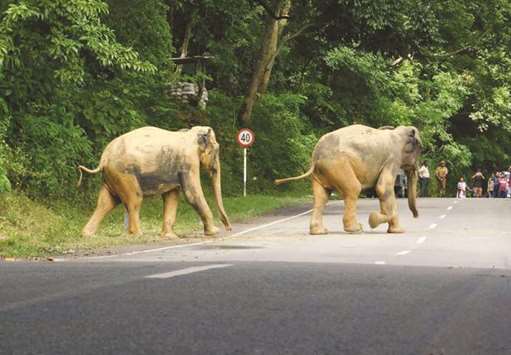
A pair of wild elephants crosses a road as they move to higher lands from the flood-hit Kaziranga National Park in Assam.


