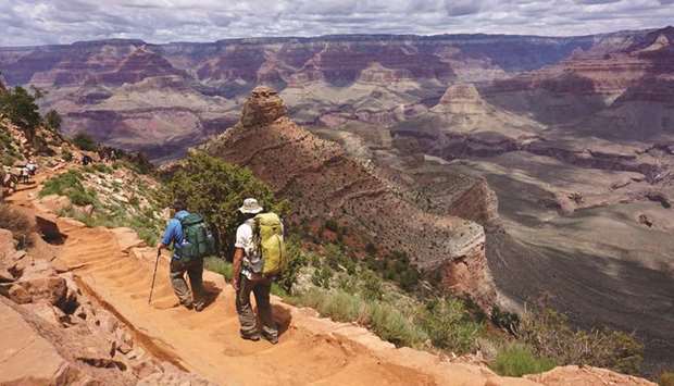
Scarcely anyone travelling the American West will make a detour past the Grand Canyon, which is celebrating its first century this year since being established as a US national park 100 years ago.
Every year, more than 6 million people visit this enormous canyon carved out by the water of the Colorado River over millions of years. But while most people hop in air-conditioned buses, or even rent a helicopter, to take them around the majestic landmark, the best way to get away from the crowds is by taking a two-day hike down into the canyon.
From the South Rim, at a height of 2,200 metres, there are two routes: the longer, and therefore less steep, Bright Angel Trail still attracts relatively heavy traffic. Less populated is the South Kaibab Trail, spanning 11 kilometres to the river, with no water source in between.
If you start the Bright Angel Trail early, it’s still possible to escape the stream of day hikers. Most people only cover the seven kilometres to Indian Garden, a small oasis on Garden Creek. A few might hike a further three kilometres to Plateau Point, a lookout about 400 metres above the Colorado River.
From there, it’s a steep downhill serpentine trek through what is called the Devil’s Corkscrew. There are no shadows here; the sun beats down mercilessly. It’s sparse on the banks of the Colorado, whose brown water moves at mind-blowing speed through the canyon.
Inflatable rafts occasionally appear, and then disappear as quickly as they came. Finally, after what feels like an eternity, the Silver Bridge is sighted, a 160-metre-long suspension bridge over the river. In the midday heat, the last kilometre is trekked on the other side of the river. The trail goes along the Bright Angel Creek, eventually ending at the Phantom Ranch. The four wooden huts where guests can spend the night feature climate control and 10 sleeping spots each.
The hospitality can be described only as rustic. There’s steak, stew or a vegetarian dish, and everything must be reserved in advance, as mules are used to haul in all the groceries.
Breakfast is served at 5am. It feels a bit early for some salted peanuts, energy bars and an apple. But by 5:30am it’s getting brighter, and the temperature is already a sweltering 30 degrees Celsius.
The hike to the North Rim is 22 kilometres and is much less busy than the trails on the southern side. But instead of 1,400 vertical metres, this path requires overcoming an altitude difference of almost 1,800 metres to reach the North Rim, at 2,515 metres.
The first 11 kilometres to the Cottonwood Campground are pure hiking pleasure. The well-paved way features lots of shade and has a gentle incline. The narrow canyon slowly widens, with red rock replacing grey slate. The lookout point just before the camp site is Ribbon Falls, draped like a curtain in front of a mossy rock face. It’s worth the extra half kilometre off the main trail.
The camping grounds are a good place to rest and replenish water supplies, which is important because the second 11-kilometre stretch is much steeper, and goes along narrow paths and steep canyon walls in some parts, while covering the final 1,300 metres of altitude. In the final miles out of the Supai Tunnel alone, trekkers must climb 450 metres. Before you reach the top it feels like you go around 100 bends, all of them exactly the same. Walking on the sandy path is hard.
Pleasure and pain. But after more than 10 hours, it’s over. — DPA

TOUGH: Hot and hard: Hiking the Grand Canyon on foot is no walk in the park.
