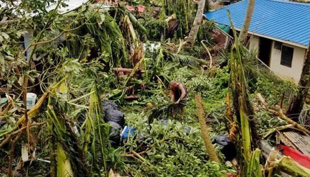
Typhoon Yutu maintained its strength as it moved closer to the northern Philippines on Sunday, prompting authorities to warn of possible floods and landslides.
Yutu was packing maximum sustained winds of 200 kilometres per hour (km/h) and gusts of up to 245 km/h as it moved west towards the northern region of Luzon, the weather bureau said in a bulletin.
‘Flooding and landslides are possible,’ the bureau said. ‘Travel by land and sea is risky.’ The typhoon was expected to make landfall over the northern provinces of Isabela and Cagayan on Tuesday morning, triggering possible storm surges, the weather bureau said.
‘Everyone is advised to refrain from outdoor activities,’ it added.
Government agencies and emergency teams have coordinated with communities expected to be battered by Yutu to prepare for the typhoon, the national disaster risk reduction agency said.
Food packs have also been prepared and positioned for fast distribution, it said.
In September, more than 100 people were killed in landslides, flash floods and other accidents caused by Typhoon Mangkhut, the strongest cyclone to hit the Philippines this year.
Each year the Philippines is hit by an average of 20 cyclones which cause floods, landslides and other accidents.
One of the strongest in recent memory, Typhoon Haiyan hit the country in November 2013, killing more than 6,300 people and displacing more than 4 million others.

