Resident Dave Donaldson stamps down sandbags outside his flooded home at Burrowbridge on the Somerset Levels in south west England.
By Steff Gaulter
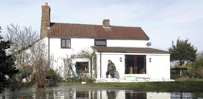
The flooding in the UK is heartbreaking. Dozens of homes in the beautiful English countryside have been inundated by floodwater. In many cases this filthy, smelly water has stagnated in the houses for weeks on end.
The despair is clear to see; grown men have been breaking down on live television. The locals are blaming the Environment Agency and, rather embarrassingly, the Environment Agency has claimed that its handling of the flooding is a ‘success’.
Certainly a lot of damage has been done and not only to people’s homes. Farmers are watching their valuable top soil wash away, roads have remained impassable for weeks and now even railway lines are being washed away.
Over the past few months, the amount of rain has been exceptional. Since the middle of December, a series of storm systems has crossed the UK in quick succession. Taken as solitary events, none of these storms were particularly out of the ordinary, but the cumulative effect certainly has been.
Much of southern England received more than double the normal January rainfall, with some parts of Oxfordshire and Hampshire receiving almost three times the average.
This was an excessive amount of rain. For many parts of the region, January 2014 was the wettest month since records began in 1910. In fact, the amount of rain could well be even more exceptional than that; the world’s longest-running weather station, Radcliffe Meteorological Station at Oxford University, reported that January was wetter than any other winter month since their records began in 1767.
Despite the fact that the rain was heaviest in central southern England, it was the southwest of the country which has been worst-hit, in a region known as the Somerset Levels. Clearly the fact that this isn’t where the worst of the weather has been, hints at the fact that the problems have been caused by drainage rather than weather alone.
Historically the Somerset Levels were marshlands and have always been prone to flooding. It is believed that the name Somerset is derived from the Anglo-Saxon word ‘Sumorsaete’ meaning ‘the people of the summer lands’, because the land could only be used in summer when it wasn’t flooded. When it wasn’t underwater, the land on the levels was incredibly fertile, so understandably throughout history people have tried to extend the farming season.
As far back as the 7th century, a series of small scale ditches and banks were constructed to divert the water, but by the 1100s there were already disputes about water. Numerous fisheries were established along the waterways, but the weirs that were constructed to keep out the floodwaters triggered flooding on the surrounding area.
The region continued to be drained between the 10th and 14th centuries, which enabled the land to be farmed throughout the year.
A narrow ditch, fringed by willow trees helped to channel the water away from the land. Of course since the 1300s, farming has changed. Over the centuries, the fields have increased in size, many of the original willow frees have been felled and many of the fields lie empty in the winter.
This ensures that when it rains, the soil simply runs off the land and into the rivers. In the last few centuries, the rivers have been dredged to ensure a smooth passage of water to the sea, but, presumably due to cost-cutting reasons, this was stopped in the 1990s.
Nowadays the water drains from the fields through a series of pipes which are laid underneath the soil. These quickly and efficiently remove the water from fields and channel it directly into the rivers. However, this efficiency has rather an unfortunate side-effect, and ensures that the rivers fill quickly whenever there is heavy rain. In an attempt to prevent the rivers overflowing, huge flood banks have been built alongside the rivers Parrett and Tone. This can mean that the level of the water in the rivers is anything up to 3m (10ft) above the level of the land.
This all goes some way towards explaining the misery of the people on the Somerset Levels. The speed with which the rivers fill when it rains, combined with their reduced capacity, means the waterways simply have not been able to cope even with the huge flood banks.
Also, given that water can only run downhill, the flood banks ensure the water cannot simply run back into the rivers. This is what happened when flooding struck the region in 2012; it stagnated on the fields. It became so polluted that the Environment Agency could not pump it back into the rivers without first treating it with hydrogen peroxide.
This year has brought exceptional amounts of rain, and this is a part of the world which is prone to flooding, so it would have been a surprise if this region had not suffered problems. In fact, according to hydrologists, the capacity of every drainage channel in Somerset could have been doubled and large parts would still have flooded.
We have known for some time that the changing climate will bring increased amounts of rain to southern England, so the Somerset Levels need to adapt. Dredging may be part of the answer, but it is also important to slow down the speed at which water currently drains into the rivers.
After the flooding of 2012/2013, a task force of farmers, wildlife groups, official agencies and councils was set up in order to guide water and land management policies over the years ahead. The task force has already agreed what needs to be achieved. The next challenge is to put in place the actions necessary to bring it to fruition, but with all the difference groups talking, the outcome looks promising.