|
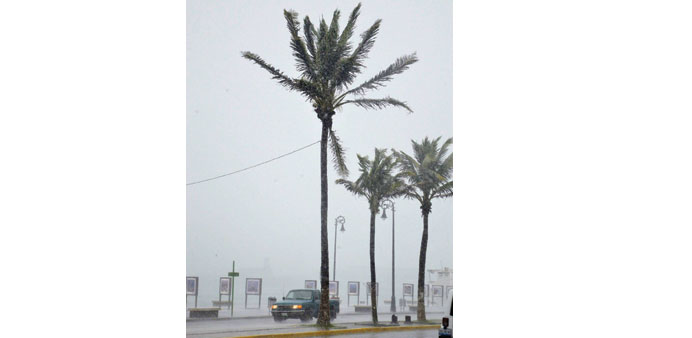
Two tropical storms are flanking Mexico on the Gulf and Pacific coasts, producing heavy rains, causing rivers to overflow and threatening to spark landslides, forecasters said. |
Tropical Storm Manuel formed off the western coast hours after Ingrid emerged in the Gulf of Mexico near the eastern state of Veracruz., according to US and Mexican weather authorities.
Tropical Storm Ingrid could become a hurricane before making landfall late today or early tomorrow, according to the US National Hurricane Center.
The Gulf storm was stationary about 95km from the port of Veracruz but was already drenching eastern Mexico, forcing villages to evacuate and causing some rivers to overflow.
Ingrid was expected to be very close to the coast over the weekend, the Miami-based Center said in a 0000 GMT bulletin. The storm was packing maximum sustained winds of 75kph.
The storm was expected to dump 10 to 15 inches of rain on a large part of eastern Mexico and more in mountainous areas.
“These rains are likely to result in life-threatening flash floods and mudslides,” the centre said.
State oil company Pemex said late Thursday that it had preemptively suspended “sea and air operations” in the area although rigs in the region continued to operate.
Heavy rain has lashed Veracruz this week, killing 14 people, including 13 people who died when a landslide crushed their homes in a mountainous region of the Gulf Coast state.
On the Pacific coast, Tropical Storm Manuel was “getting a little bit stronger” as it moved slowly westward, the US hurricane center said.
The storm was moving at 9kph, and was located some 290km from Lazaro Cardenas, a Michoacan state coastal city.
The storm, blowing maximum sustained winds of 75kph, was expected to be close to the southwestern coast early today and produce floods and mudslides.
An official with Pemex said the company was closely monitoring Ingrid, but has not ordered any major installations to be closed. Still, the travel of oil workers in the area both by air and ship has been “temporarily interrupted” until the weather improves, Pemex said in a statement.
On its Twitter page, Pemex also said preventative actions were being taken to safeguard “personnel, platforms, ships and installations.” It did not give further details.
Pemex’s Floating Production, Storage and Offloading (FPSO) vessel located in the Ku Maloob Zaap oil field, Mexico’s biggest, has been closed since Friday morning, according to the transport and communications ministry. When operating normally, the FPSO directly exports crude to docking oil tankers.
Both Cayo Arcas and Dos Bocas, two of Mexico’s main oil terminals, were closed. The port of Coatzacoalcos was closed to small boats, but open to larger ships, the ministry said.
Oil export hubs often shut intermittently during the hurricane season, but export deliveries are usually only affected if the closures are prolonged.
Ingrid was about 97km east of Veracruz, with maximum sustained winds of 97kph, the NHC said.
Pemex’s main oil fields as well as Dos Bocas and Cayo Arcas are all located in the vicinity of the storm, in the shallow waters of the Bay of Campeche. The Lazaro Cardenas refinery in Veracruz state is closest to the projected path of Ingrid.
Ingrid was expected to dump between 10 inches and 25 inches of rainfall over a large part of eastern Mexico, which could cause rivers to swell and provoke flash floods and mud slides, according to the NHC.
The Mexican government has issued a hurricane watch north of Cabo Rojo to La Pesca, the NHC said. A tropical storm warning is in effect from Coatzacoalcos to Cabo Rojo.

