 |
|
|
This has been made possible with the help of researchers at Carnegie Mellon University’s Robotics Institute in Pittsburgh, working with colleagues at Google and the US Geological Survey (USGS).
This new capability within Google Earth Engine enhances the public’s ability to view the massive amount of imagery collected by the Landsat programme between 1999 and 2011. Users can watch a time-lapse animation of these 13 years of imagery for any place, zoomed in to almost any vantage point on a map.
This “time-explorable” map can only be viewed in Google’s Chrome a
 nd Apple’s Safari web browsers (go to Google Earth Engine, click through to one of the featured galleries, and a link “Explore Map” will appear below, taking you to the map).
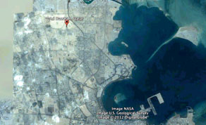
This enables anyone to see the rapid creation of Doha Metropolitan area, the sprouting of artificial islands at the Palm Dubai and the urbanisation of the desert throughout Abu Dhabi, as well as the growth of many other megacities in the region like Istanbul or Tehran.
For the past 40 years, the Landsat programme has continuously collected imagery of the Earth’s surface and, since 2008, the USGS has made that imagery available free to the public.
“But accessing that data - measured in petabytes, or quadrillions of bytes - has long been cumbersome,” said Randy Sargent, a system scientist at Carnegie Mellon’s Robotics Institute’s CREATE Lab in Pittsburgh and a visiting researcher at Google.
Google has improved access by building the largest library of Landsat imagery on hard-drive storage, Sargent explained.
Google Earth Engine has already amassed more than 1.5mn Landsat images of Earth and this is growing by thousands of images per day as new satellite data is collected.
The new tool for Earth Engine, based on Carnegie Mellon’s GigaPan Time Machine technology, takes this access to another level.
When combined with Google Earth Engine’s massively parallel computation power, the Landsat image archive is transformed into a set of seamless, zoomable videos easily accessible from a modern web browser.
“The sheer volume of visual data is daunting to explore by conventional means,” said Rebecca Moore, engineering manager of Google Earth Engine.
“Together we can now offer an intuitive, effortless method to explore the planet in space and time,” she observed.
Google, Nasa and Carnegie Mellon previously collaborated to create GigaPan, a technology for capturing a mosaic of hundreds or thousands of digital pictures and stitching those frames into panoramas that can be interactively explored via computer.
GigaPan Time Machine, developed with Google’s support, took advantage of the HTML5, a markup language for structuring and presenting content for the World Wide Web, incorporated into such browsers as Google Chrome to extend GigaPan into the realm of video.
Sargent, along with CMU colleagues Paul Dille and Chris Bartley, developed algorithms and software architecture that made it possible to shift seamlessly from one video portion to another as viewers zoom in and out of the imagery.
One of the first applications of the Time Machine technology was to 12 months of imagery from Nasa’s Moderate Resolution Imaging Spectroradiometer, or MODIS, satellites. “The success of that project led directly to the effort to create a tool for accessing Landsat and other satellite imagery available through Google Earth Engine,” Sargent said.
The enhanced access to satellite imagery will help ground public discussions about land use, climate change and environmental policy.
“You can continue to argue about why deforestation has happened,” he explained, “but you no longer will be able to argue whether it happened.
“Exploring the data is now much faster - hundreds of times faster than it used to be,” he added. “That leads to discoveries. That leads to making connections.”
Videos demonstrating how the time-lapse tool can be used to explore phenomena such as deforestation, urban growth and drying seas can be viewed at http://earthengine.google.org/#intro.
In addition to Sargent, Dille and Bartley, computer science student Richard Hofer, Robotics Institute intern Saman Amirpour and Illah Nourbakhsh, professor of robotics and director of the CREATE Lab, have contributed to this project.
They are continuing to work with Google scientists to increase access to additional imagery from Landsat and other satellite programmes.
The Robotics Institute is part of Carnegie Mellon’s School of Computer Science, which oversees an undergraduate degree programme at Carnegie Mellon University in Qatar.
Consistently top ranked, Carnegie Mellon has more than 11,000 students, 90,000 alumni and 5,000 faculty and staff globally.
It was in 2004 that Qatar Foundation invited Carnegie Mellon to join Education City, a groundbreaking centre for scholarship and research.
Carnegie Mellon Qatar offers undergraduate programmes in biological sciences, business administration, computational biology, computer science and information systems.
Carnegie Mellon is firmly committed to Qatar’s National Vision 2030 by developing people, society, the economy and the environment.