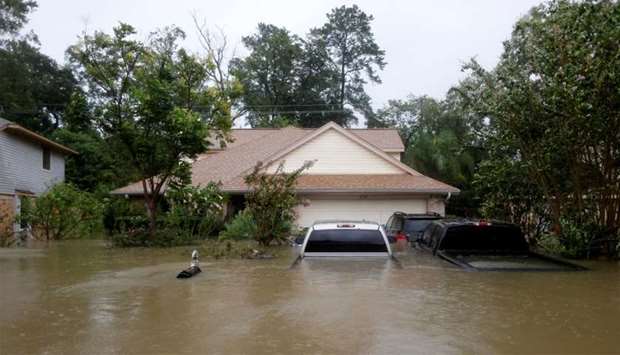
Two more days of heavy rainfall are expected over parts of Texas and Louisiana as Tropical Storm Harvey churns offshore, preparing to make landfall again on Wednesday.
‘The single greatest threat continues to be the rainfall,’ Dennis Feltgen, a spokesman for the Miami-based National Hurricane Center, told AFP, describing the situation as ‘catastrophic.’
‘This is not over,’ he said.
Already, some 50 inches (127 centimeters) of rain have fallen over Houston since Harvey hit Friday as a Category Four hurricane, sparking massive floods across the metro area that is home to 2.3 million people.
Harvey is edging away from Houston and is currently in the Gulf of Mexico.
With neighboring Louisiana squarely in the storm's path, Harvey, now a tropical storm, is pressing eastward and is expected to make landfall again late Tuesday or early Wednesday.
Residents of New Orleans are bracing for heavy rain and flash floods over the next two days.
As of Tuesday morning, two inches of rain had already fallen over New Orleans.
‘Flash flooding is expected to begin shortly,’ said the National Weather Service in New Orleans.
The city famous for its jazz music and cuisine is particularly vulnerable because it lies below sea level, and is fresh off another major flood earlier this month that was exacerbating by problems with the city pumping system.
‘It is really sort of a wild card right now,’ meteorologist Eric Holthaus told AFP.
‘There are some forecasts for up to 10 inches of rain over the next 36 hours or so for New Orleans. I would definitely not be surprised if it became more than that.’
Houston can expect two to four more inches of rain as the storm moves away, but flooded conditions will likely linger through the end of the week as the rainfall drains off, Holthaus said.
Forecasters say Harvey will likely dissipate after it hits land again, and the rains should be all but over by Thursday.

