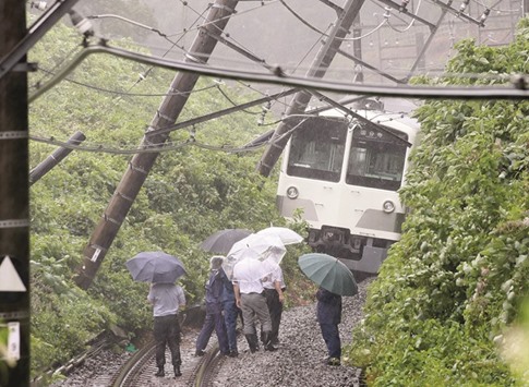
The first of the recent run of storms to make landfall was Tropical Storm Chanthu. Chanthu grazed the east coast of the main island of Honshu, before making a direct hit on the northern island of Hokkaido on August 17. It weakened as it tracked north, so the country avoided major damage, but as it passed close to the east coast of Honshu, some of the major cities, such as Tokyo, Yokohama and Sendai, saw heavy rain. In Hokkaido, which saw some of the most severe weather, the ground became saturated.
Just four days later, another storm slammed into Japan. Tropical Storm Kompasu followed a disturbingly similar path to Chanthu: tracking northwards, just off the east coast of Honshu, before slamming into Hokkaido. Many cities along the east coast of Japan saw heavy rain, and once again the island of Hokkaido suffered the worst of the weather. Following so soon after the previous storm, the soil was already waterlogged and the extra rain caused the Tokoro River to flood, forcing thousands of people to evacuate their homes.
Less than 24 hours after Kompasu hit the country, almost before the locals had time to draw breath, another storm slammed into the islands. This storm, called Mindulle, was stronger than the previous two and it edged slightly further west, meaning that it actually hit Japan’s largest island of Honshu.
Just before making landfall to the east of Tokyo’s city centre, the storm intensified sufficiently for it to be classed as a typhoon. Narita, Tokyo’s international airport, was battered with winds of 126 kilometres per hour (78 miles per hour), which triggered an evacuation of the air traffic control tower. The airport was shut until the worst of the storm had passed and hundreds of flights were cancelled from Tokyo, which affected tens of thousands of people.
However, it’s important to remember that the strength of the wind is rarely the most destructive aspect of a tropical system. I haven’t been able to find any statistics for Japan, but in the US, nearly nine out of ten deaths from tropical cyclones are caused by water. A storm surge is the most dangerous element of a storm. A vast amount of water is usually pushed ahead of the swirling storm, and as this rushes on shore, it can cause major flooding.
Rain is also a major hazard and the amount of rain that a storm will deliver cannot be neatly tied to its wind speed. Even if the storm is a weak tropical storm or a tropical depression, it can still cause major flooding, particularly if the storm is moving slowly. In the case of Typhoon Mindulle, it may not have been a very strong typhoon, but it still gave phenomenal amounts of rain.
As the typhoon approached, the national meteorological department issued warnings of flash flooding and landslides. The two previous storms had ensured the ground was saturated and Typhoon Mindulle promised yet more torrential downpours. Parts of Tokyo reported 105 millimetres of rain from the storm, which is two thirds of the rain they would normally expect in the entire month of August.
Elsewhere the rain was even heavier. Hachijo Island and Izu, to the southwest of Tokyo, both measured 86 millimetres of rain falling from the sky in just one hour. Given that this is nearly half the rain that would be expected in the entirety of August, this is clearly a deeply concerning amount of rain. Flash flooding was inevitable.
In Japan there are strict building regulations, which means that most homes and businesses should be able to withstand strong winds and heavy rain. However, the topography of the nation works against the safety of the residents. Rivers run steeply down the slopes of the mountains, but their sharp gradient means that they flow rapidly and are prone to flooding.
The angle of the slope also ensures that when the ground is saturated it is very prone to landslides. Water adds a lot of extra weight to the soil, meaning it is more susceptible to the pull of gravity. This can lead to the mountainside becoming unstable, resulting in walls of mud tearing loose and hurtling down into the valley. Even after a storm has passed, the risk of a landslide remains high until the ground dries out again.
Despite the battering that is often delivered by a tropical storm, the Japanese are a very optimistic nation. They have an expression for the good weather that is usually observed after a typhoon has passed. Taifu Ikka, literally translated as ‘typhoon once past’, refers to the unusually clear skies and extremely fresh air that tend to follow in the wake of a storm. The extreme weather washes away any pollution or impurities in the air. The land may be flooded and the threat of a landslide may not have passed, but the air is clear and that is a reason to be grateful.

