There is an intricate relationship between the oceans and the atmosphere. Perhaps the most obvious demonstration of this in the eastern Pacific Ocean. This region of sea warms and cools naturally over time and it has a dramatic effect on the weather around the world.
Recently the eastern Pacific has been warmer than usual, a situation known as El Nino. At its peak in December 2015, the water reached some of the highest temperatures ever recorded, and was easily the warmest it had been for nearly 20 years. As a result, the knock on effect on the weather was equally as extreme.
In December 2015, Argentina, Paraguay, Uruguay and Brazil were hit by their worst flooding for at least 50 years. More than 160,000 people were displaced as the incessant rains caused a number of major rivers to overflow their banks.
In March, officials in Thailand announced they were in the grip of their worst drought for decades. In some of the country’s biggest dams, the water level dropped below 10 percent.
In May, Ethiopia was hit by torrential rain. The resulting floods and landslides killed more than 100 people and left more than 20,000 families homeless.
These are just a few of the impacts of El Nino. Now the waters in the Pacific are gradually cooling, many places are breathing a sigh of relief. However, even the decline of El Nino isn’t without its hazards. It has been noticed that as the waters of the Pacific Ocean cools, there is often a particularly intense monsoon season over China.
Certainly the monsoon has been very active this year. According to a spokesperson for China’s Office of State Flood Control and Drought Relief Headquarters, the flooding along the Yangtze River Valley has already killed 237 people and caused at least $22 billion worth of damage.
This makes the 2016 floods China’s second most expensive weather-related natural disaster in history. Only the 1998 floods were more costly, causing $44bn of damage. The floods of 1998 also occurred as the waters of the Pacific were cooling. The El Nino of 1997-1998 was the strongest El Nino on record, and the intensity of the monsoon over China as it eased reflected this very clearly. Given that China’s monsoon lasts until October, it is highly likely that the cost of this year’s damage will rise.
The surface waters of the Pacific Ocean are now far cooler than they were and can no longer be classed as ‘El Nino’. However, it’s thought they won’t stay at their neutral conditions for too long. Often a warming of the Pacific is followed almost immediately by its cooling, and this is known as La Nina. Of the 14 La Ninas which have been recorded since 1950, nine have followed hot on the heels of El Ninos and all have started within two years of an El Nino event.
There is the risk, therefore, that La Nina, will emerge by the end of the year. In fact some of the meteorological agencies are putting the chance as high as sixty percent. If we do see La Nina conditions, they could well stay with us for a long time. The cooling of the Pacific generally lasts longer than its warming, and after the immense El Nino of 1997-98, a La Nina event developed which lasted for an incredible 33 months! Given that the recent El Nino event was comparable to the 1997-98 event, there is the chance that the next La Nina could be equally as long.
As well as lasting longer than El Nino events, La Ninas also tend to have a smaller impact on the temperature of the ocean. The strongest La Nina on record reduced the temperature of the Pacific Waters by 1.9C, whereas the strongest El Nino on record increased the temperature by 2.3C. Although the change in temperature might be smaller, the weather in many parts of the world are still likely to be changed dramatically
La Nina occurs because the winds across the Pacific blow stronger than usual. This pushes the warm surface water out of the way, towards Indonesia, revealing the cooler water underneath. As cool air does not evaporate as easily, the coast of South America often experiences a drought during La Nina. Meanwhile, the warm waters which have been pushed towards Indonesia, encourage rain, meaning Indonesia and many other parts of southeast Asia often experience heavy rain that triggers flooding.
These are the direct impacts of La Nina, but across the globe there are many indirect impacts as well. These are often the opposite effects to those experienced during an El Nino year. Therefore Argentina, Paraguay, Uruguay and southern Brazil would expect a drought, whereas Thailand would be on alert for flooding.
La Nina also brings a risk for those people living in the Caribbean. The atmosphere is so intricately balanced that cooler waters in the Pacific affects the speed of the winds travelling high up in the atmosphere above Central America. This encourages the growth of tropical storms and it has been seen that there are far more storms and hurricanes during a La Nina year.
Many impacts of La Nina have been closely monitored over the decades, but what lets meteorologists down is the forecast of the oceans. It is still notoriously hard to predict the state of the ocean, and the current prediction that La Nina will emerge by the end of the year is only 60 percent. Countries cannot prepare for the floods, droughts and storms unless they know they are coming.

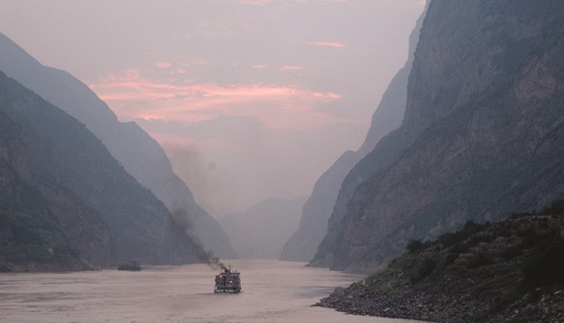
A file photo of dusk on Chang Jiang (Yangtze). The flooding along the Yangtze River Valley has already killed 237 people and caused at least $22 billion worth of damage. Photo by Andrew Hitchcock/Wikipedia
